Carlisle, despite its ever increasing size with housing and industrial development, has retained several areas of green space. The most obvious are the largest: Rickerby, Bitts, Upperby and Morton Parks, for example. However, Carlisle also has a designated set of nature reserves that compliment these large, classic-style parks. This blog will explore current conservation practice being deployed in the Kingmoor Sidings reserve, evaluating its effectiveness in relation to biodiversity.
The Kingmoor Reserves are three areas of predominantly woodland, each linked by footpaths. Notably, the three sites are split by hard borders; roads and industrial development.
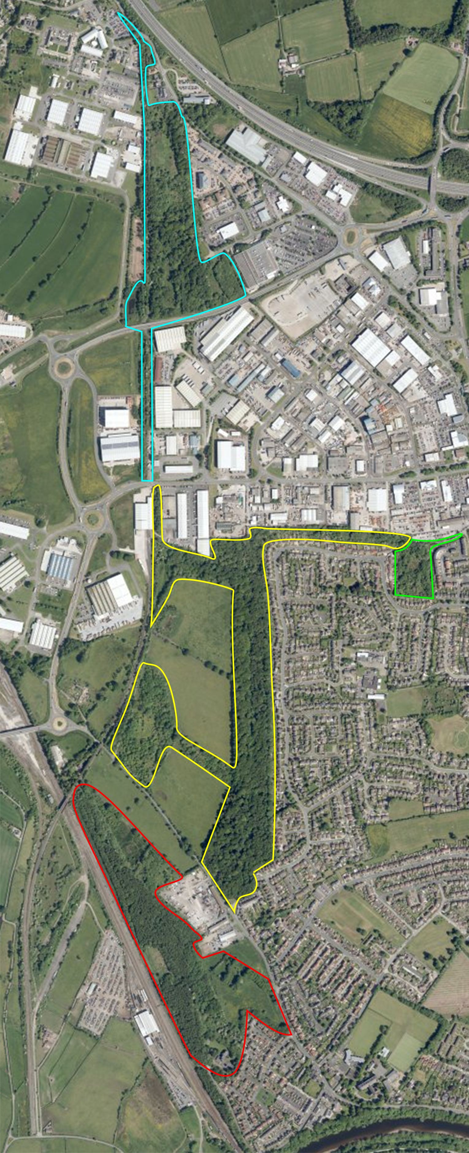
Fig. 1 - Map of Kingmoor Reserve sites (Johnson, 2020)
Kingmoor Sidings in Red
Kingmoor South in Yellow
Kingstown Pond in Green
Kingmoor North in Blue
The Kingmoor North reserve is quite different to the other reserves in the area. A hardcore, sometimes tarmac, path winds its way through the reserve, with large areas inaccessible having been left to grow of its own accord. A thin strip of tree-lined pathway links the North reserve to the South. The entrance at the northern end of the Kingmoor South Reserve is fairly unassuming. Pathways dive off in different directions in a more random nature than Kingmoor North. Heading south, the reserve becomes very natural and open, with squirrels scooting up trees and slow moving waterways bisecting different areas of the reserve. Coming to the main entrance at the south end of the reserve, a large metal sign greets visitors into a gravel car park. At the upper end of the South Reserve, nestled amongst the large housing estate bordering the reserve, is the Kingstown Wildlife Pond. This area is a more recent development compared to the others, with a dedicated platform and information boards recently completed.
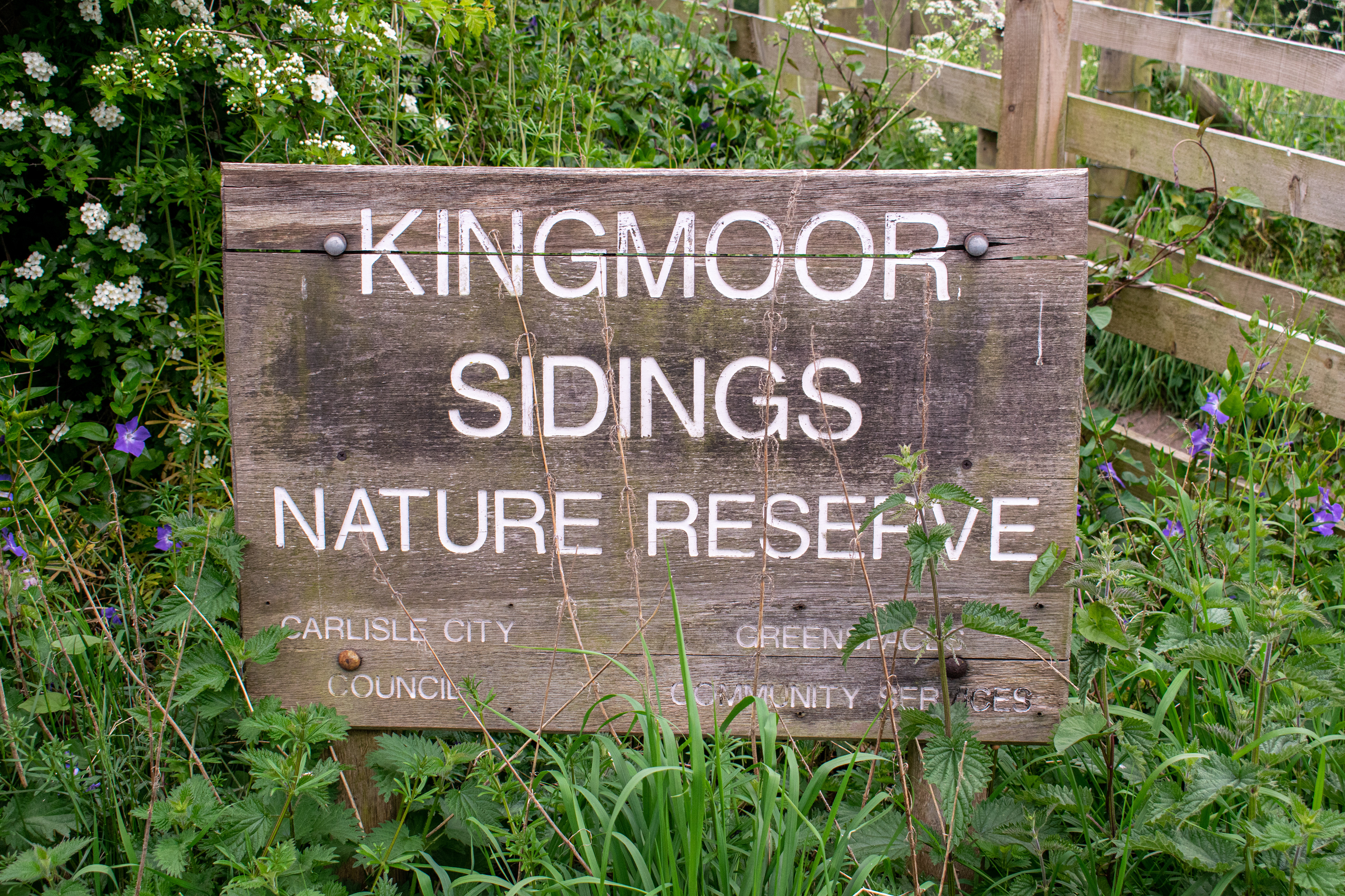
Fig. 2 - Kingmoor Sidings entrance sign (Johnson, 2020)
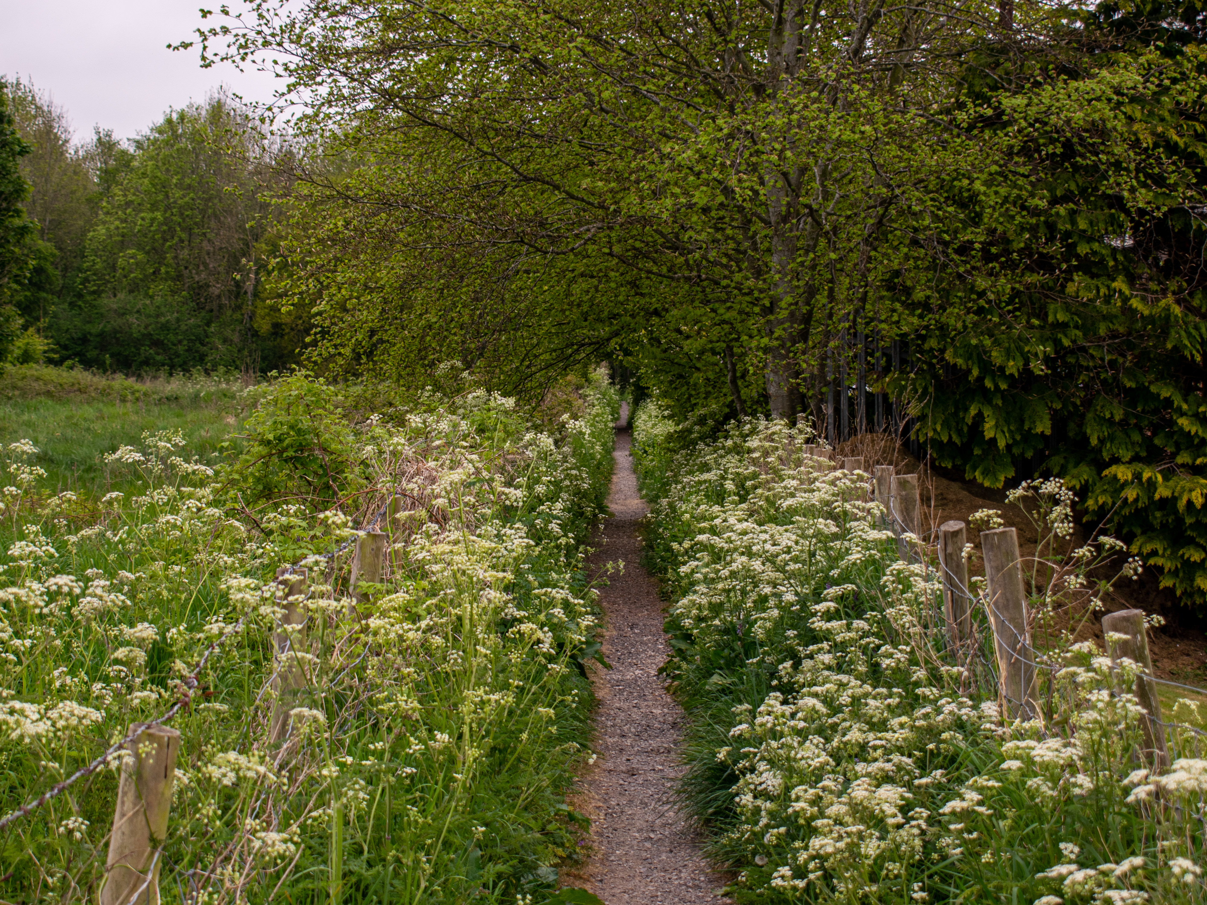
The Kingmoor Sidings Reserve is the Southernmost reserve: occupying an area alongside the railway that passes through the city. This area was once a locomotive and storage depot, used for refuelling and repairing steam engines, loading freight and offering a place for drivers to house themselves mid-journey. The yard was closed in 1968, left for wildlife to take over (Clough, 2015). The reserve is separated from the others; a main road runs between it and the entrance to the South reserve. It is a varied area, with remnants of the rail yard still present, including rails, concrete surfaces and general railway paraphernalia. The West Coast Mainline running to Glasgow passes alongside the reserve, with a large freight depot situated on the opposite side of the track.
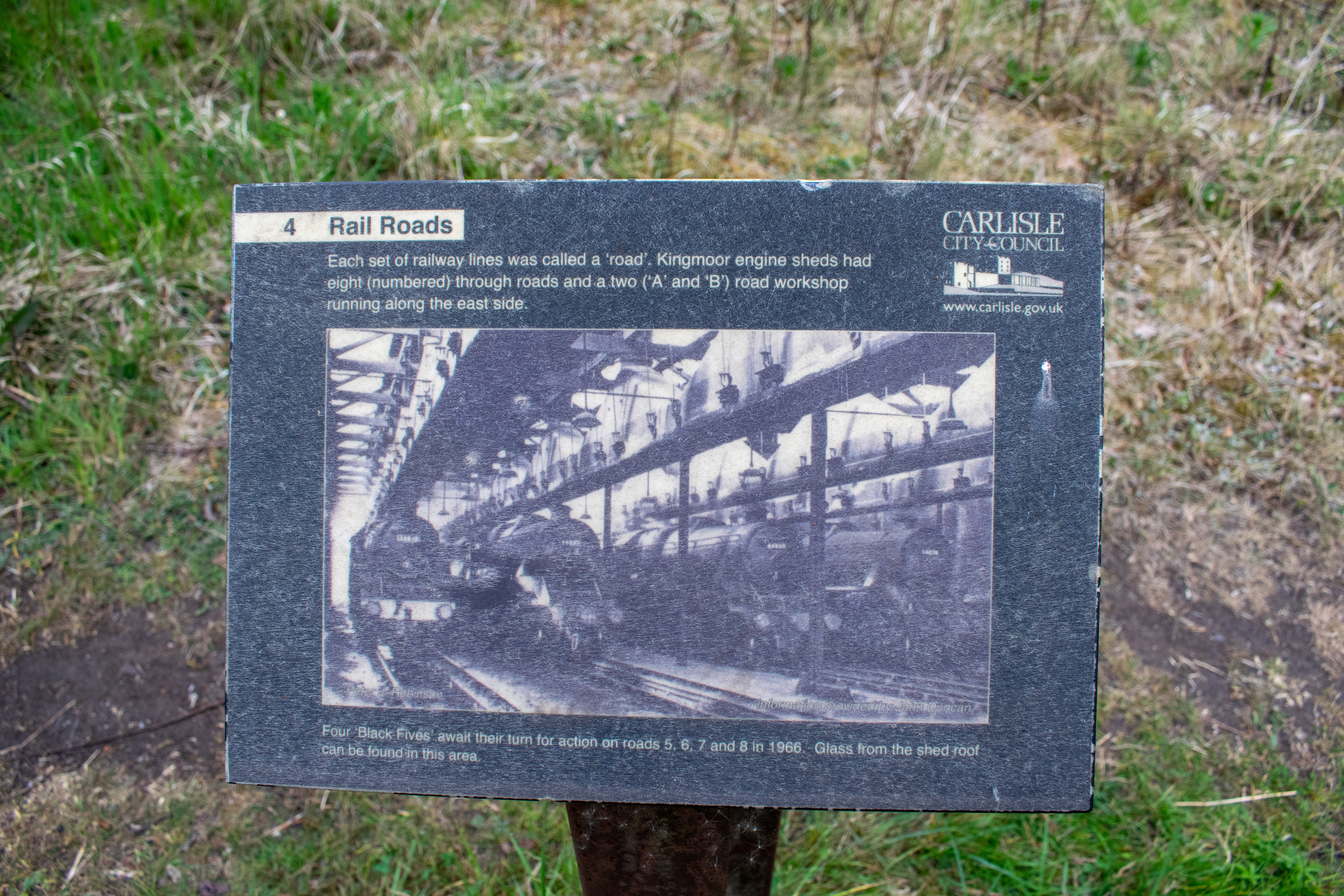
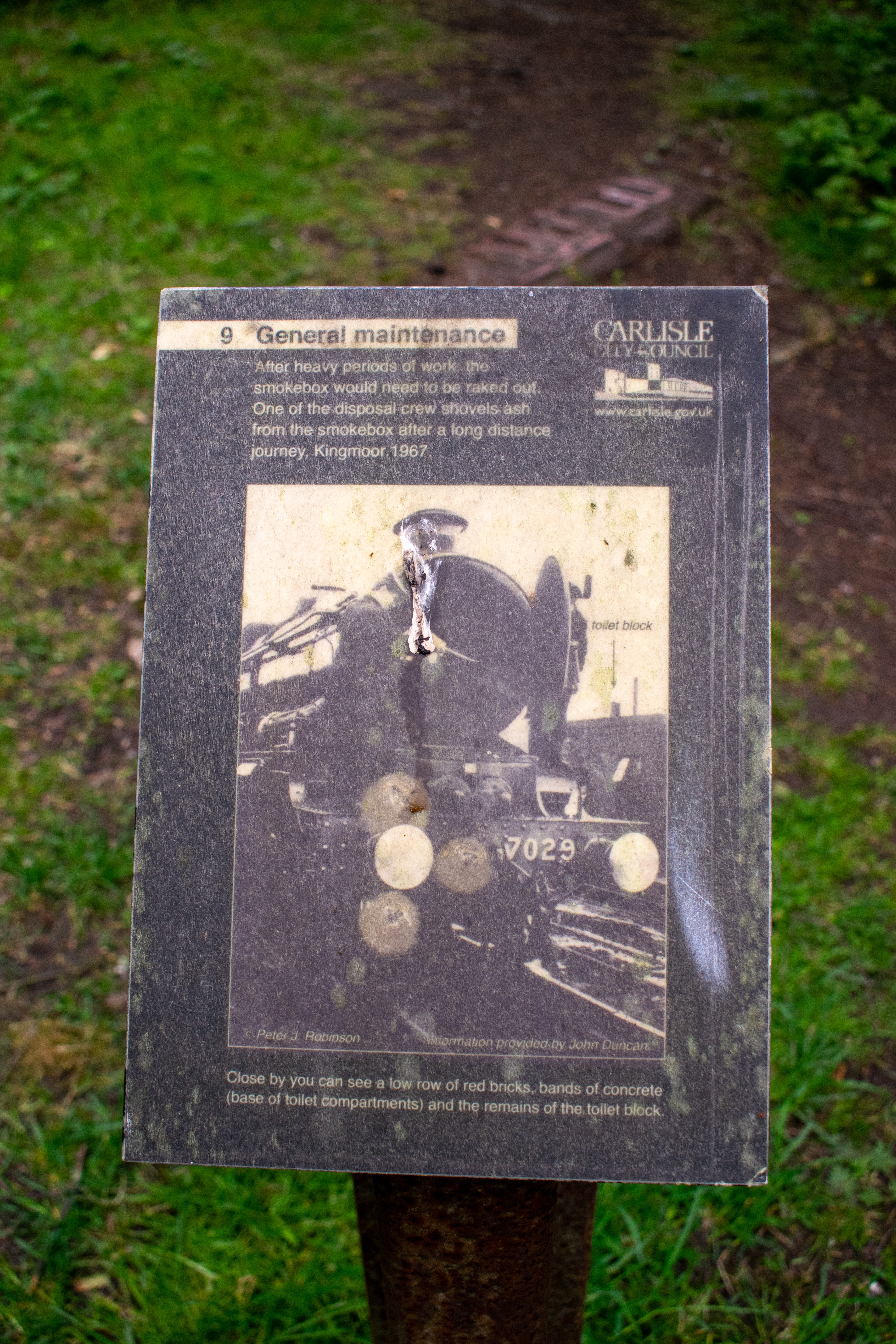
Fig. 3 - Information boards located around the Sidings Reserve (Johnson, 2020)
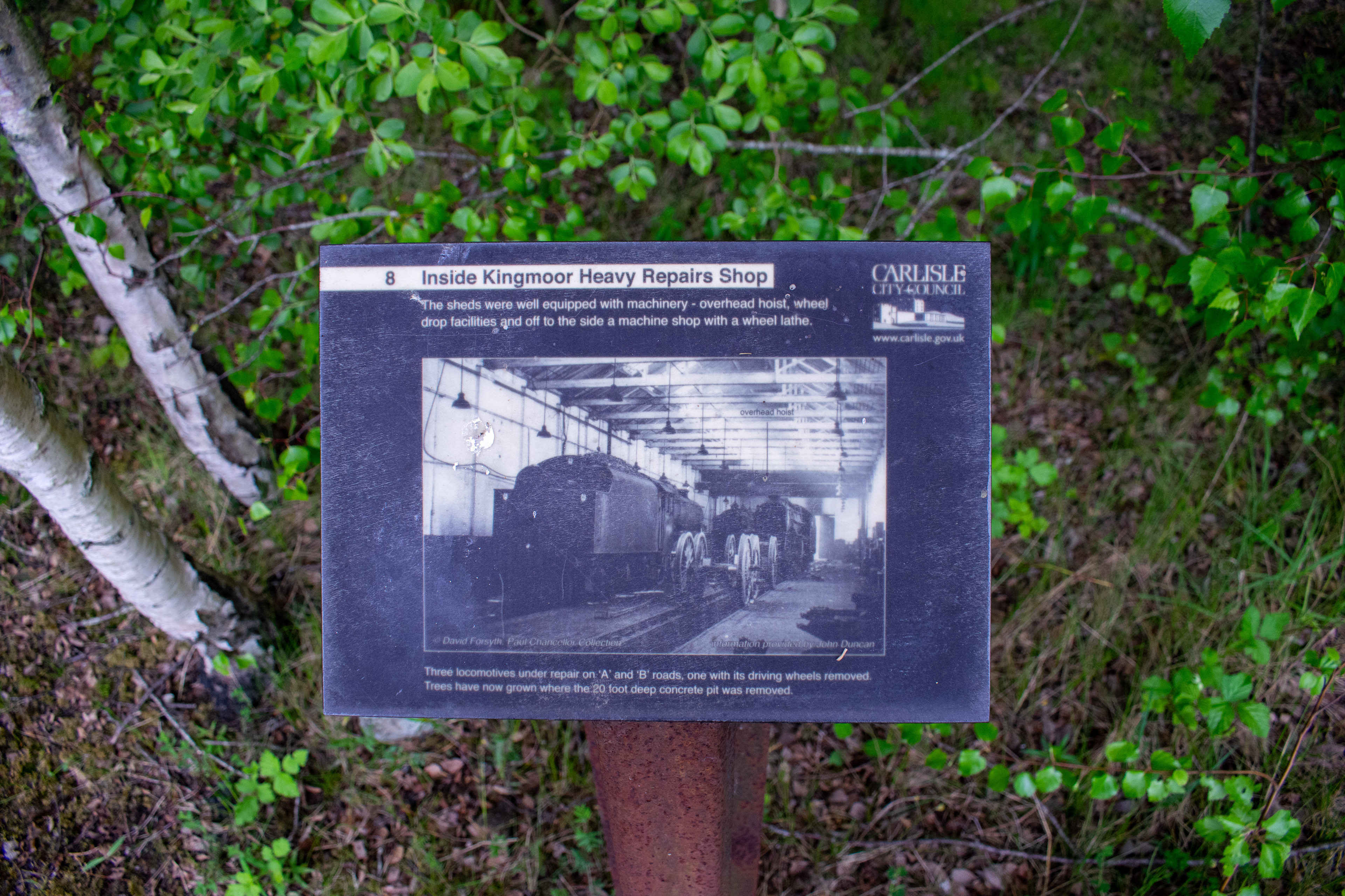
The Sidings reserve is an informative journey, with information boards located around the site detailing its past use: pictures from its time as a rail yard help to explain the significant changes the site has undergone, showing nature's power to change landscapes. Pathways run through various different areas of the reserve, with offshoots stemming from wide, main paths. The make up of the ground is predominantly stone; there is little surfacing on the paths, as they are tough enough already.
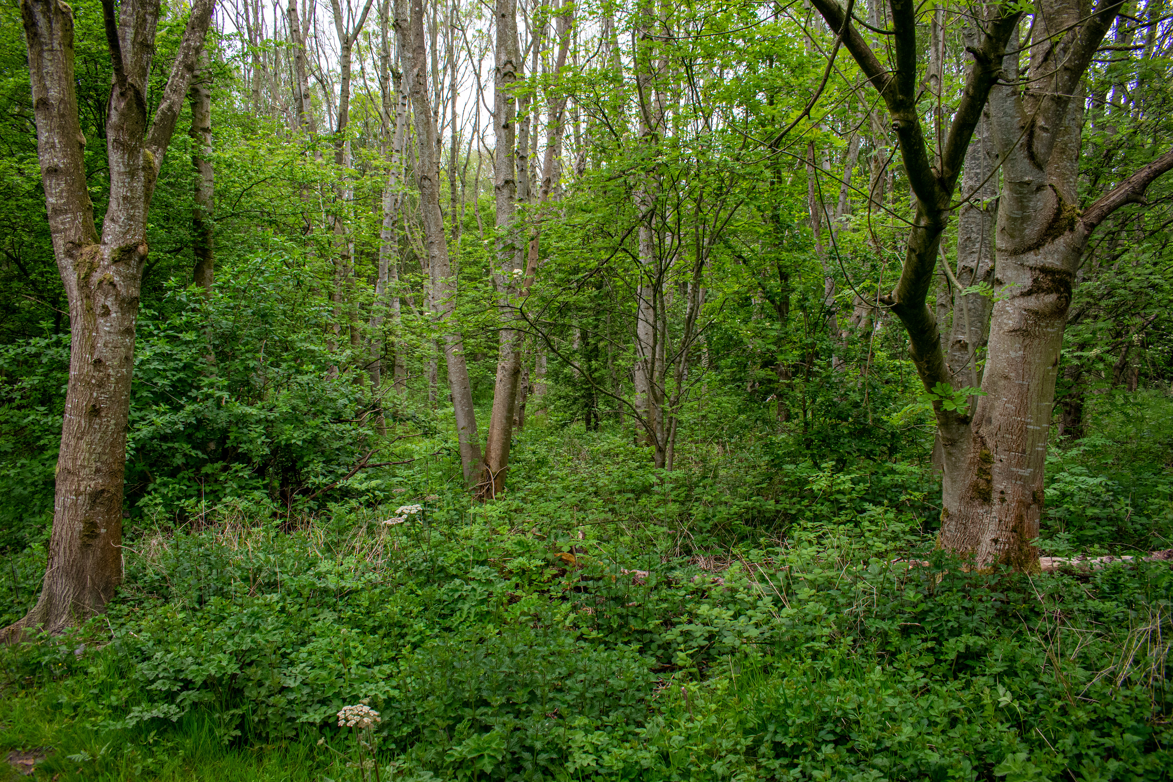
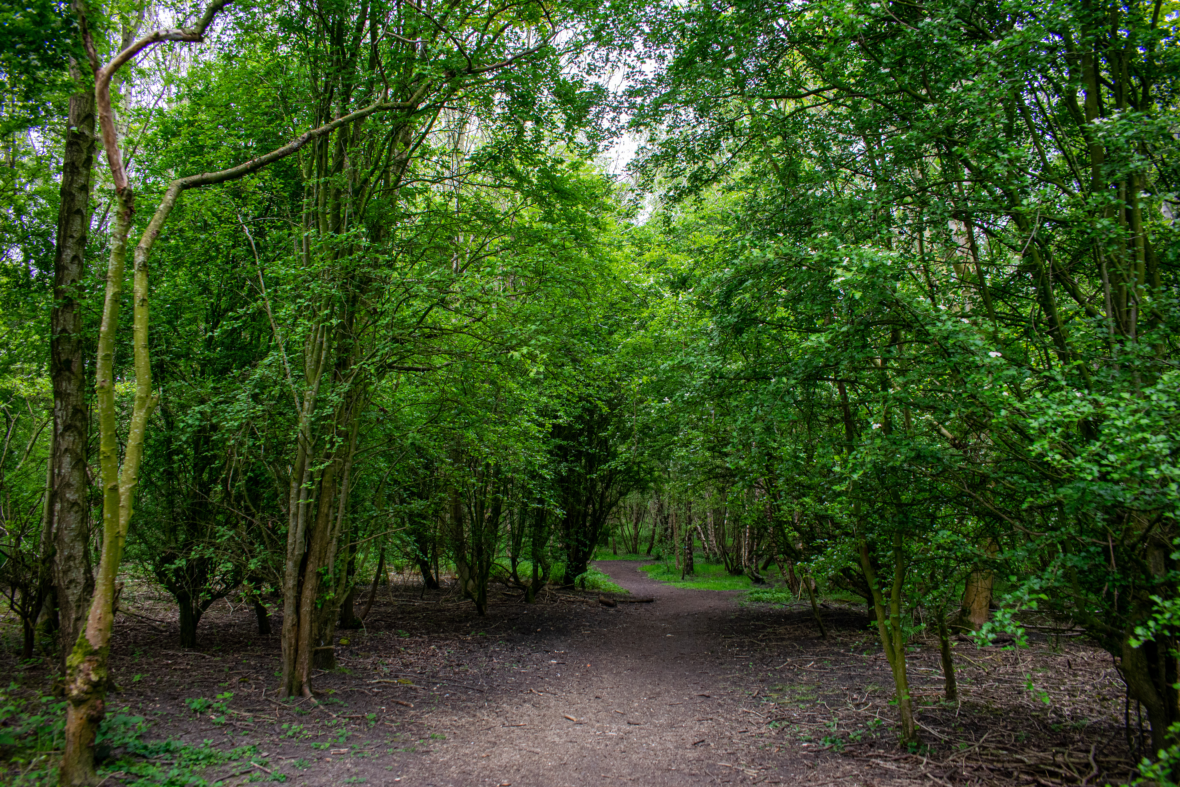
Fig. 4 - Habitat variance in the Reserve (Johnson, 2020)
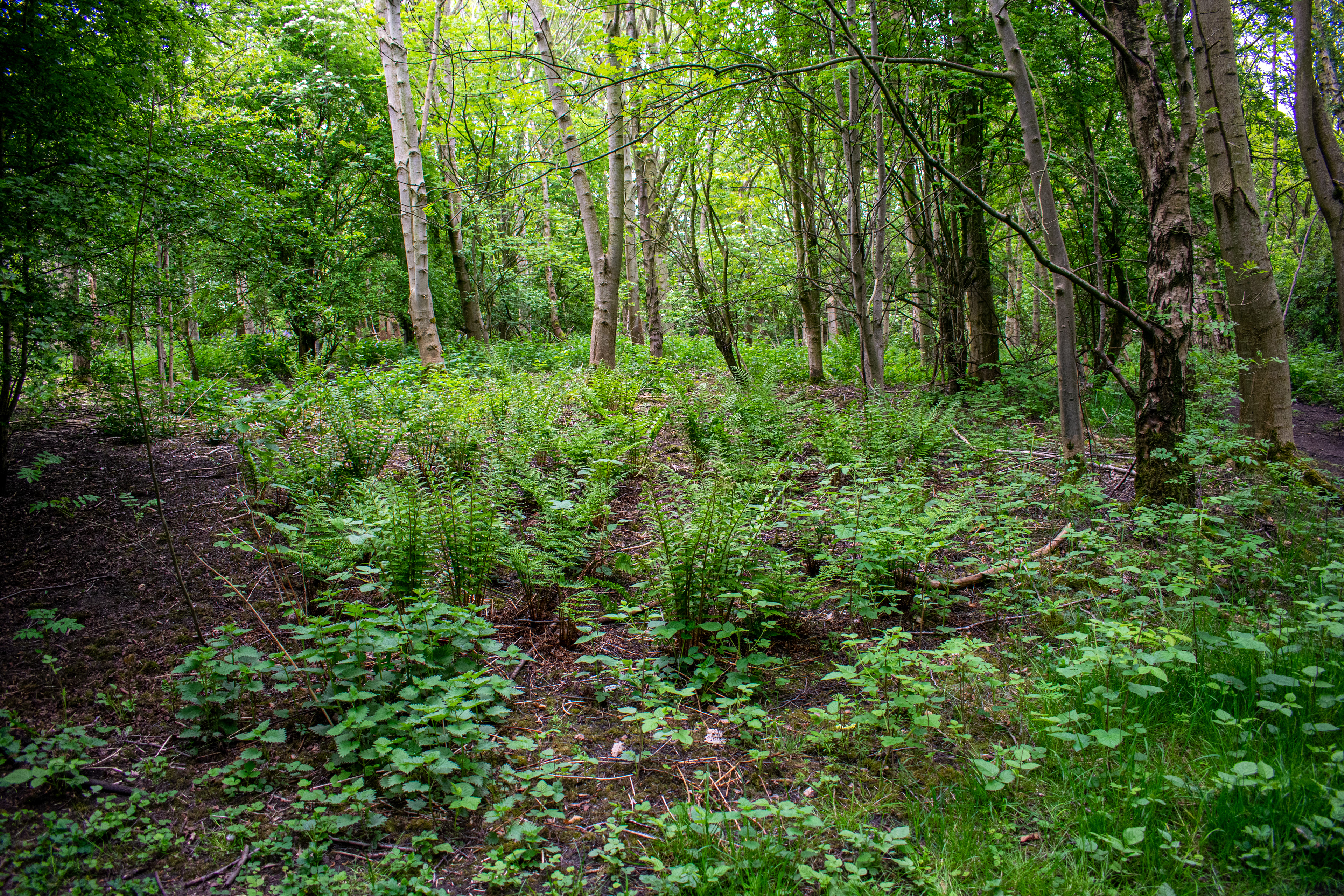
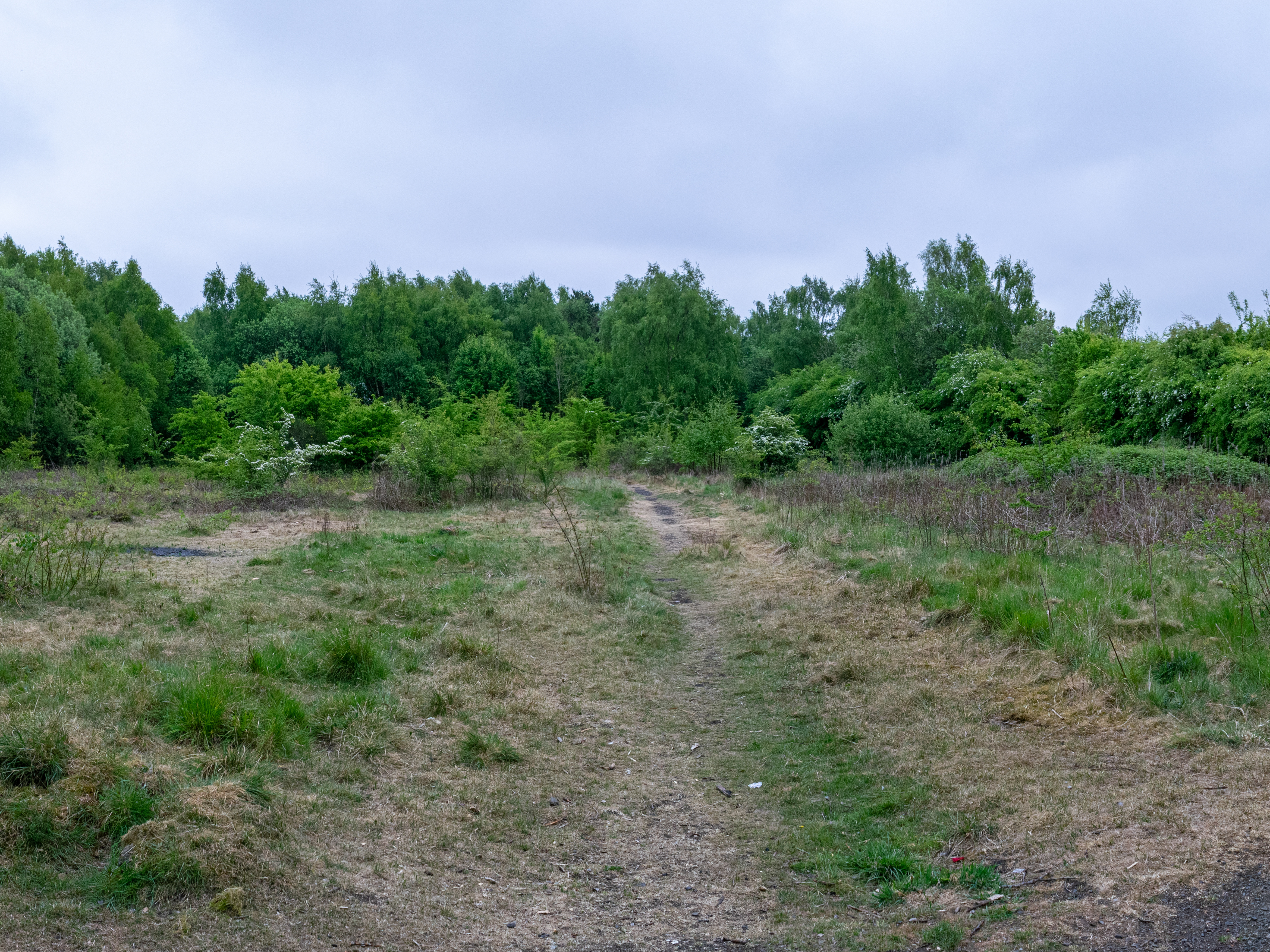
The reserve itself contains many different habitats: fields, shrubbery, open and dense woodland, some wetland and hedgerow. The site is very diverse, with mixed species woodland giving way to small pockets of open areas, wide paths separating habitats and even a throne!
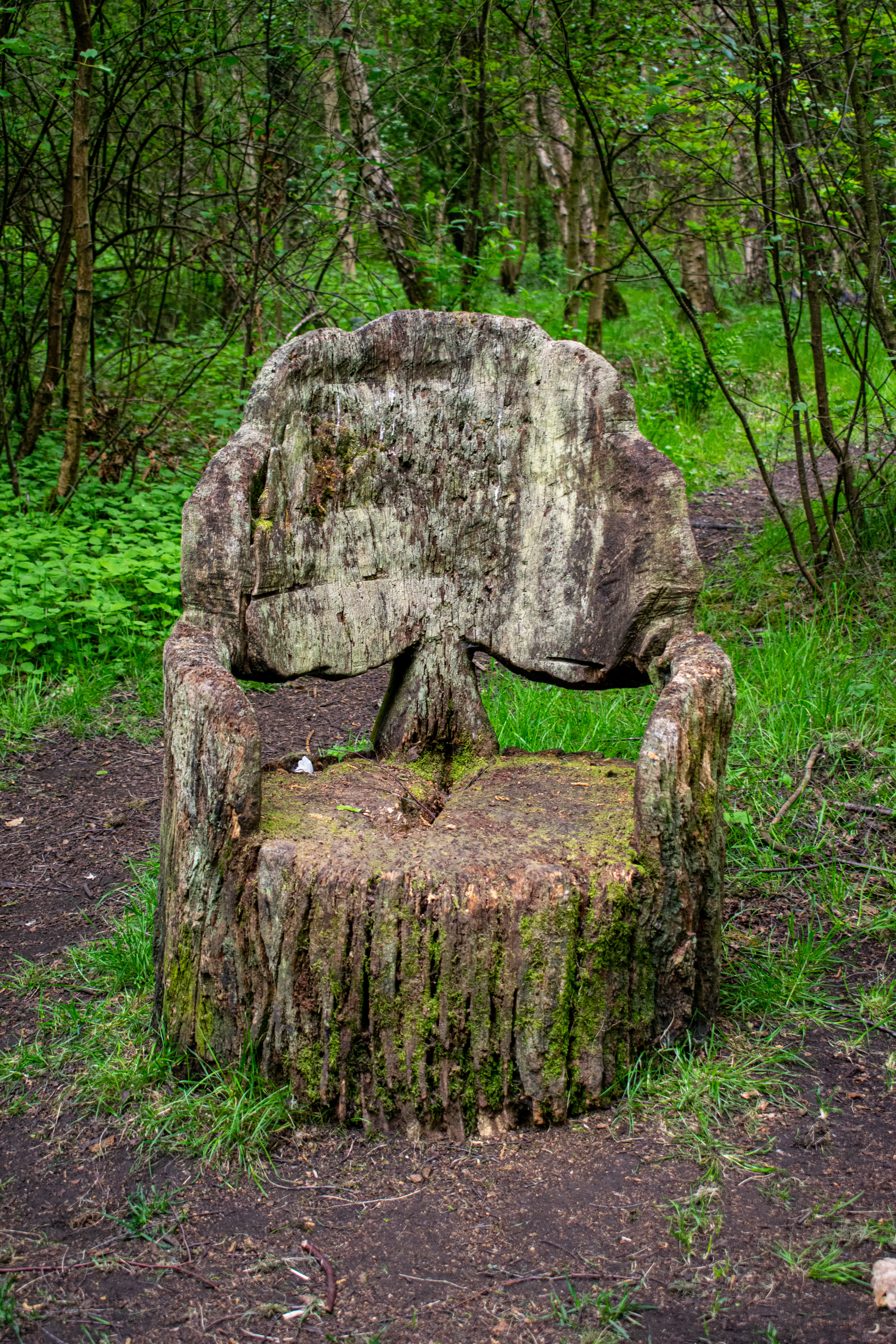
Fig. 5 - Carved wooden throne in the Reserve (Johnson, 2020)